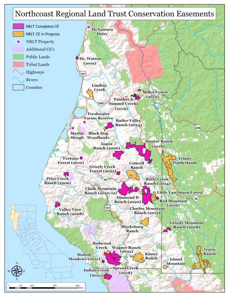
The Northcoast Regional Land Trust has permanently protected more than 65,000 acres throughout northwestern California. Most of this land belongs to private landowners and is not open to the public but we invite you to read about these special properties by exploring the map below.
Want to get out on a public access trail? Visit our Freshwater Farms Reserve property.
-
Chalk Mountain Ranch
Chalk Mountain Ranch
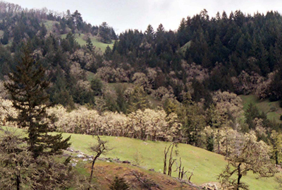
3,268 acres protected in 2010, 4,012 additional acres protected in 2012; a Six Rivers to the Sea property. The Barnwell Family has lived on Chalk Mountain Ranch, near the town of Bridgeville, CA for more than 125 years. “Our primary goal is to keep the land that has been in our family for six generations. Keeping one’s land intact is becoming increasingly difficult these days,” says Les Barnwell. “We want to keep Chalk Mountain a working ranch and timberland, as well as continue to offer recreational activities.” The Barnwells worked with the Land Trust to place a conservation easement on 7,280-acres of the ranch, located in the Larabee Creek watershed. Chalk Mountain Ranch is naturally scenic: conifer forests line its slopes and canyons and open oak woodlands and grasslands cover a good portion of the property. Its perennial streams and creeks provide good spawning and rearing habitat for native salmon and steelhead trout, and on iconic Chalk Rock, a pair of peregrine falcons has fledged every year since 1979. In addition, the Barnwells have diary records of the falcons from the 1920s. The first phase of the easement was completed at the beginning of 2010. This, and the subsequent 2012 easement on the Barnwell’s property, eliminated the potential for negative impacts caused by development, such as road sediment, water diversions and diesel pollution. The conservation easements also helped to protect clean drinking water for people living in the downstream communities of Fortuna and Ferndale. -
Charles Mountain Ranch
Charles Mountain Ranch
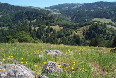
2,903 acres protected in 2011, 4,437 additional acres protected in 2012; a Six Rivers to the Sea property. Jackie and Tim Pricer decided to protect their property “to keep it a working ranch” and eliminate the potential of subdivision.
Forest uses on the Charles Mountain Ranch have traditionally been integrated with ranching. The Pricers also open the ranch to guided deer hunting during the fall season. The ranch is a hunter’s delight for the scenery is expansive and wild: extensive grasslands fill with wildflowers in the spring, deep gorges dissect resplendent oak woodlands, deep green conifer forests harbor an occasional craggy old-growth tree, and the spectacular Charles Mountain is often snow-capped during the winter months. At least 24 miles of streams flow through the property into Larabee Creek and then to the Van Duzen River and Eel River. Wildlife known or likely to occur on the property include: northern goshawk, red tree vole, western pond turtle, summer-run steelhead trout, and osprey. It is also a historic activity center for the federally threatened northern spotted owl, and golden and bald eagles have been observed on Charles Mountain Ranch. The ranch’s southern border, Alder Point Rd, was the old stage route from Humboldt Bay to the San Francisco Bay Area.
-
Diamond D Ranch
Diamond D Ranch
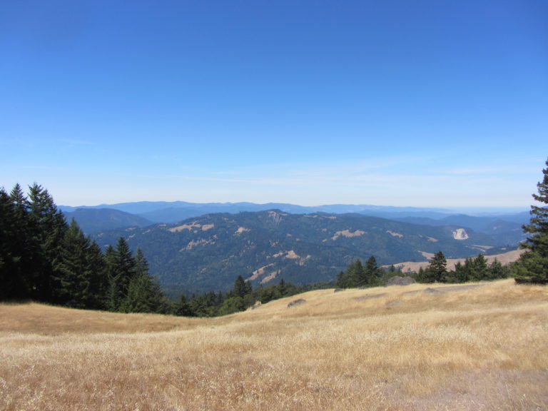
2,960 acre conservation easement in progress. Located between the previously conserved Charles Mountain and Chalk Mountain Ranch easements in eastern Humboldt County, completion of the Diamond D Ranch conservation easement will form a privately-conserved corridor of over 17,000 acres. Thanks to a grant from CAL FIRE’s California Climate Investments Forest Health Program, together with a generous donation from landowners Trenton, Macy, and Jennifer Dunn, the Diamond D Ranch Conservation Easement will ensure that this working property stays intact and that the family’s stewardship of the land can continue for future generations.
-
Dr. Watson Conservation Easement
Dr. Watson Conservation Easement
13 acres protected in 2011. In 2010 the late Dr. Louise Watson bequeathed a 8-acre property in Trinidad to the Northcoast Regional Land Trust. Dr. Watson was a professor at Humboldt State University who loved people, wildlife and organizations that work to protect open space. Louise realized long ago that her special Trinidad property could be at risk of development. She loved nature and the wildlife that used the forest, meadow and riparian areas on her homestead.
Louise had also gifted an adjacent 5-acre property to Humboldt State University with the intent to maintain the land in its native state. Upon receiving our gift from Dr. Watson’s estate, we immediately began working with HSU to reunite all thirteen acres of Dr. Watson’s property under a single conservation easement that would go into effect when the property sold. Now, a new landowner is enjoying this 13-acre coastal, residential and open space property. And, our Land Trust has permanently protected the open space wildlife habitat on the property through a conservation easement in Dr. Louise Watson’s memory.
-
Fortuna Family Forest
Fortuna Family Forest
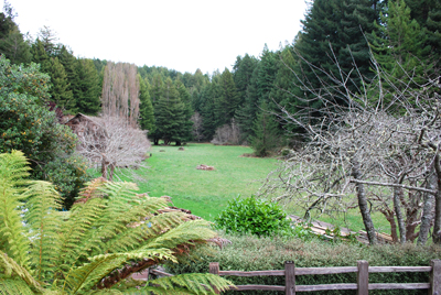
74 acres protected in 2009. In memory of Susan Parks, Lynn and Gary Baker, Nancy and Richard Head, and Robert Parks partnered with the Northcoast Regional Land Trust to conserve their 74-acre forest, located just above and visible from the City of Fortuna, through a conservation easement. The overall purpose of the easement was to assure that the forestland would remain in its relatively natural, scenic, and productive condition.
The landowners donated the easement so that “the forest and open space will remain intact, offering a great value to our community”. The protection of this forest, with its tributaries to the Strongs Creek Watershed, will forever provide a source of clean drinking water for downstream residents and spawning habitat for federally-listed coho and chinook salmon.
The agreed upon terms of the conservation easement do not allow for new residential development on the property, even if the property changes ownership. The landowners will continue long term sustainable forestry practices, enhancing both the health of the predominantly redwood forest, its soils and ecosystems.
-
Freshwater Farms Reserve
Freshwater Farms Reserve
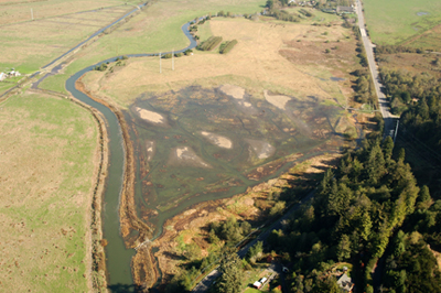
54 acres protected in 2005, 20 acres protected in 2012. In 2005, the Land Trust purchased 54 acres of bottomland pasture from neighboring Freshwater Farms Nursery to facilitate a wetland restoration and enhancement project and to maintain agricultural uses. In 2012, NRLT acquired the 20-acre Freshwater Farms Nursery property reuniting it with the Freshwater Farms Reserve for a total of 74 acres.
Located in an area historically dominated by tidal wetlands, the property was converted to pasture in the early 1900’s to support the growing agrarian culture in Humboldt County. Wood Creek, which runs through the property, meets with Freshwater Slough and is part of the larger Humboldt Bay tributary complex. The Land Trust, recognizing the need to reclaim wetland habitat that is vital to the successful rearing of salmon and steelhead, as well as other wetland-dependent species, worked with numerous public and private groups to design and implement the restoration. For details on the Freshwater Farms Reserve project click here.
Elements of the restoration included: removal of a wooden-flap tide gate; construction of 3,200 feet of slough channels; removal of a 300-foot berm on the north bank of Wood Creek; construction of three habitat ponds; replacement of an old, crushed culvert with a modified flatbed trailer bridge; construction of tidal hummocks (shallow hills subject to tidal inundation); and revegetation of the entire project area with over 46,000 native wetland plants. All but the last activity were completed in late 2009. The planting phase began in late March and was completed by mid-April, 2010.
The Land Trust has also continued to work with a local rancher to improve and maintain 20 acres outside of the project area for agriculture. In addition, the Land Trust hosts regular school and public field trips to the property to educate our community on wetland ecology, restoration, and productive, multiple-use land management.
In 2015, NRLT completed a 0.75 mile nature trail, allowing daily access for community members. The Freshwater Nature Trail offers ample opportunities to identify native plants and trees, view birds of prey and other wildlife, learn about the local history and ecology, go boating from the non-motorized boat launch, view the restored area from a raised boardwalk, and take in the impressive views of the Kneeland Mountains and adjacent pastures.
NRLT plans to do additional capital improvements on the property including: rehabilitating the historic Graham-Long Dairy Barn and rejuvenating the native plant nursery and garden. NRLT is also in the process of planning a second phase restoration project on Wood Creek, which will create additional habitat for salmonids upstream of the Phase 1 restoration. For more details on the Freshwater Farms Reserve property click here.
-
Grizzly Mountain Ranch
Grizzly Mountain Ranch
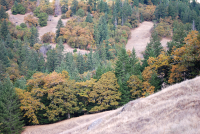
1,131 acres protected in 2008; a Six Rivers to the Sea property. Ross Burgess, a fourth generation rancher from Zenia, in southwest Trinity County, wanted an easement on his land “to assure that Grizzly Mountain Ranch remains both economically and environmentally sustainable throughout time.”
The Ranch has portions of Mud and Bluford Creeks, tributaries of the Eel River, running through it. Protections for these watersheds ensure healthy habitat for the threatened steelhead trout found here, as well as several other sensitive aquatic and terrestrial species. The productive capacity and traditional land use for sustainable human enterprise will be maintained on the land as well. Mr. Burgess and his step-children run a small herd of cattle and he has placed a non-industrial timber management plan on his ranch to promote sustainable forestry. The ranch also provides alternative energy in the form of hydroelectric power generation, and is managed for carbon sequestration. Mr. Burgess is also in the non-timber forest products business: he harvests and wholesales Pacific Bay leaves which are used to produce Christmas wreaths and garlands.
-
Hunter Ranch
Hunter Ranch
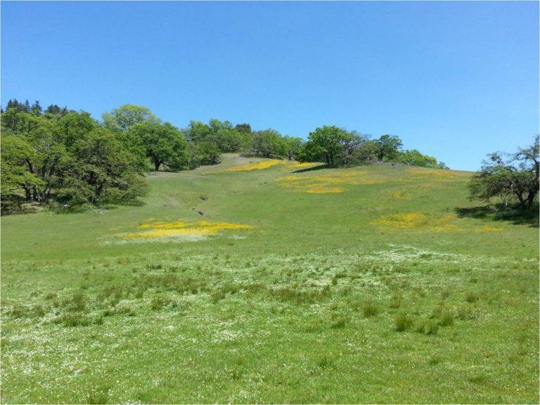
15,682 acres protected in 2018. In partnership with the California Wildlife Conservation Board (WCB) and the landowner of the Hunter Ranch this completed project allows NRLT to permanently
hold and steward the 15,682-acre conservation easement in eastern Humboldt County, nearly doubling the number of acres conserved by NRLT. The protected property includes thousands of acres of beautiful oak woodlands, mature Douglas-fir forest, rolling grasslands, and many miles of frontage on the Mad River. This property has deep cultural significance due to its location within the Pilot Ridge Archaeological/Historic District, which is listed on the National Register of Historic Places. The Pilot Ridge area was traditionally used as a seasonal hunting ground and includes what are thought to be some of the earliest human settlements in the region.
The conservation partnership between NRLT, WCB, and the landowner will prevent subdivision of this expansive ranch, protecting its remarkable habitat and rich cultural history while providing for continued cattle ranching, a sustainable working forest, and long-term stewardship of the property.
-
Iaqua Ranch
Iaqua Ranch
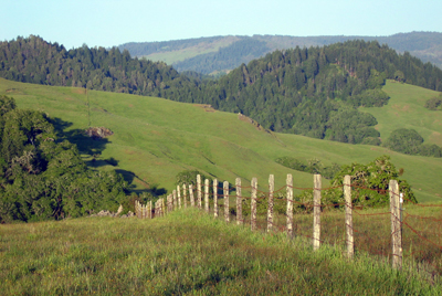
4,747 acres protected in 2006; a Six Rivers to the Sea property. The conservation easement on Iaqua Ranch works well for landowners Francis and Carole Carrington. “It’s a win-win situation….there’s compensation for some of the development value that’s given up, but the easement allows for continued grazing, timber harvesting, and hunting”, reflected Mr. Carrington.
The picturesque and natural resource-rich ranch consists of rolling grasslands, resplendent oak woodlands, productive conifer forests, and miles of fish-bearing streams. The easement prevented the ranch’s 44 distinct parcels from being subdivided and developed into smaller residential properties. The easement also provides broad public benefits by protecting and enhancing water quality and supply, wildlife habitat and connectivity to ensure biodiversity, and cultural and economic vitality though forest sustainability. Due to its size and visibility from a county road, Iaqua Ranch also provides open space and scenic views.
3.5 miles of tributaries flow to through Yager Creek and its North Fork, all within the boundaries of Iaqua Ranch. This watershed harbors significant populations of coho and steelhead salmon and provides extensive winter chinook spawning grounds. There are also natural ponds at the headwaters of Iaqua Creek, and myriad of springs and meadow wetlands. Golden eagles are commonly seen on the property, and tracks of mountain lion can be readily be found. Red and yellow-legged frog, red tree vole, and a wealth of other common species like black bear and blacktail deer are also frequently observed on the property.
-
Indian Creek
Indian Creek
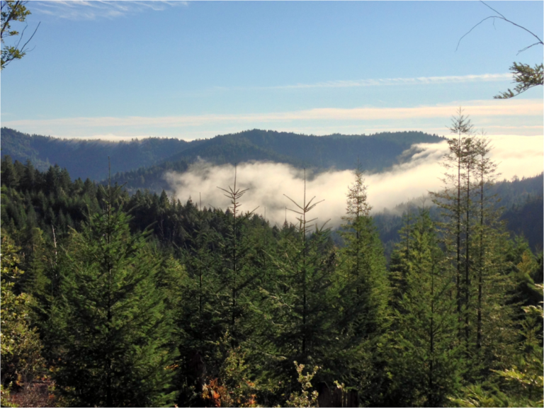
2,703 acres protected in 2018. Located in the South Fork Eel River watershed, this easement will conserve forestland and critical salmon habitat.
This easement connects the Sinkyone Wilderness State Park with thousands of acres of privately conserved lands preventing habitat fragmentation and development, while protecting salmon habitat and conserving redwood and Douglas-fir working forests. While NRLT will hold and monitor the easement, this project could not have been completed without our landowner partner and project partners at the CA Wildlife Conservation Board, CA Department of Fish and Wildlife, CA Natural Resources Agency, and National Fish and Wildlife Foundation.
With the completion of this easement, NRLT has conserved nearly 28,000 acres in 2018.
-
Martin Slough
Martin Slough
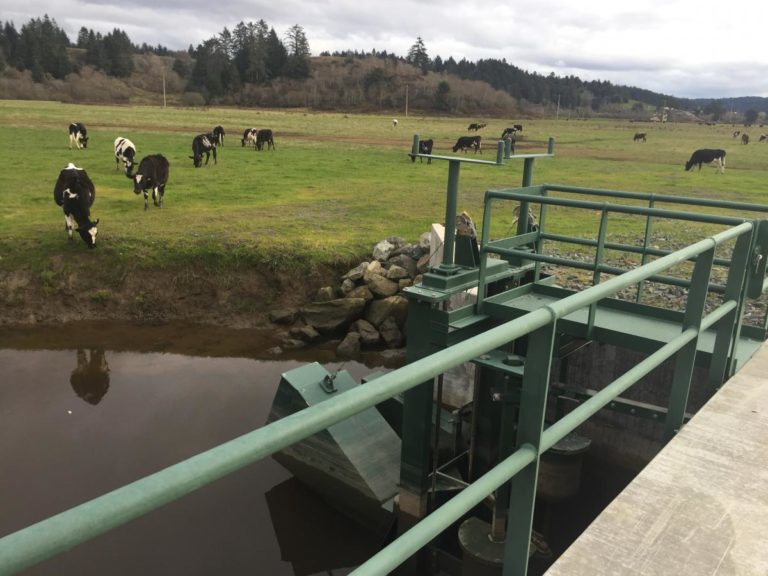
43 acres, purchased in 2011. In 2008 NRLT was approached by the Redwood Community Action Agency’s Natural Resource Services Division and the California State Coastal Conservancy to become a partner in the Martin Slough Enhancement Project, a two-phase fish passage improvement, wetland enhancement, and flood reduction project on the south side of Eureka. The Land Trust came on board with this project to purchase a 43-acre agricultural property at the mouth of Martin Slough in order to facilitate the first phase of the restoration, which included replacement of the defunct tide gate at the mouth with a more fish-friendly and functional tide gate. The phase one project also involved widening of the lower Martin Slough channel to increase flow capacity, construction of four acres of tidal wetland, establishment of riparian habitat along the slough, and enhancement of 28 acres of productive coastal pasture for grazing.
Martin Slough hosts salmon and other aquatic species that use the Eureka Municipal Golf Course’s irrigation ponds for rearing habitat. In the second phase of the enhancement project, a number of the irrigation ponds on the Golf Course will be expanded to improve the available salmon habitat and the ability to contain flood waters, thereby increasing the number of days on which the Golf Course is playable and agricultural fields are available for grazing.
NRLT will continue the agricultural lease on the property, while staying an active participant in the habitat restoration planned for the property. With the completion of the Martin Slough Enhancement Project, we will see a native system restored and increased productivity on existing agricultural properties on Eureka’s scenic periphery.
-
McNamara Dairy
McNamara Dairy
77 acres, purchased in 2009. The Northcoast Regional Land Trust, in cooperation with Western Rivers Conservancy and through a grant from the CA State Coastal Conservancy, acquired the 77-acre McNamara Dairy for the purpose of agricultural production and wetland/estuary restoration. Located in the rural community of Orick, the property lies on the northern bank of Redwood Creek, identified as one of the most important historic fisheries in Northern California. The purchase included two distinct, though connected, pastures and infrastructure, including fencing and five dairy production-related structures.
NRLT has initiated discussions with various individuals and entities that are involved in the management of the lower Redwood Creek watershed, and has made a concerted effort to introduce itself as a cooperative partner and responsible neighbor in the region. The Land Trust negotiated a lease with a local beef cattle producer, and will continue to work with them to improve the pasture quality, re-build dilapidated fencing, and enhance wetland habitat. We aim to steward the McNamara Dairy in a manner that aligns with our mission to protect and enhance farms and wild areas in perpetuity.
-
Miller Forest
Miller Forest
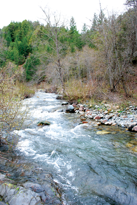
1,622 acres protected in 2012. Steve Miller, the owner of the Miller Forest, inherited the property from his father, who had purchased the property due to an increased demand for Port Orford cedar (POC) immediately prior to and during World War II. The younger Miller wished to preserve a contiguous single parcel and commence sustainable, selective timber harvest (Douglas fir and hardwoods) on certain areas of the property, while establishing timber reserve areas and riparian protection zones. The goal of these protection zones is to preserve the existing healthy stands of POC on the property, which fall in the southern extent of their range. These protection zones were created adjacent to and buffering USFS-owned POC reserves and old growth mixed conifer stands currently managed by the Six Rivers National Forest as ecological reserves. In addition, stands of Oregon white oak and canyon live oak will be preserved in these areas. Watercourse protections have been established along Three Creeks, Summit Creek, Panther Creek, and Willow Creek, to protect water quality and instream habitat for salmonid use and overall watershed health.
The Miller Forest conservation easement provides an opportunity to fill in a significant void within a large area of conserved and managed forest in eastern Humboldt County. With neighboring parcels owned by private timber and US Forest Service, protection of the Miller Forest completes a continuous forest system that links the Willow Creek basin to the top of Indian Field Ridge. Within this area, riparian protection zones and timber reserve areas provide a permanent prohibition on commercial timber harvest, and with it, maintenance of vital terrestrial and aquatic wildlife habitat.
-
Panther – Summit Creek
Panther – Summit Creek
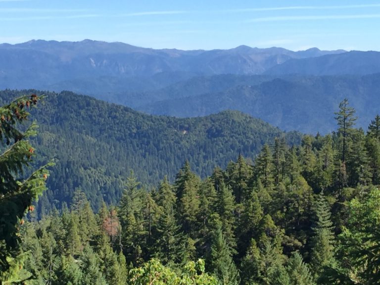
412 acres protected in 2019. The three easements, Panther Creek and Summit Creek I & II will conserve working forestlands, vital streams, wildlife habitat, and significant stands of Port Orford cedar in perpetuity.
These easements are adjacent to a property previously conserved by NRLT, the 1,600-acre Miller Forest, as well as the 950,000-acre Six Rivers National Forest. Together these lands provide habitat connectivity and buffer previously conserved areas from subdivision and development. Most significantly, the newly established conservation easements expand a Port Orford cedar reserve
-
Price Creek Ranch
Price Creek Ranch
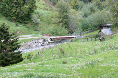
1,280 acres protected in 2006; a Six Rivers to the Sea property. The Price Creek Ranch is located in the Eel River Valley in Humboldt County, California. Because of the size and location of Price Creek Ranch (5 air-miles west of Rio Dell and 6 air miles SSW of Fortuna), a conservation easement was highly desirable, as it was being threatened by residential sub-division. Landowner Arlin Grandy looked to future generations, “This ranch has been in my family for three generations, and this agreement helps me keep the ranch in one piece for my grandkids.”
This land was highly suitable for a conservation easement because of the family commitment to restoration, and the property’s proximity to other conservation areas. It is contiguous with the 3,660-acre Howe Creek Ranch Conservation Area and Humboldt Redwood Co. lands (under habitat conservation plan), which are in turn adjacent to Humboldt Redwoods State Park, and as such has extremely high value as a wildlife corridor.
The conservation values of the Price Creek Ranch include its perennial grasslands, riparian habitats and highly productive timberlands. The conservation agreement ensures that long term sustainable production of high quality forest products will continue. Price Creek, a tributary to the Eel River, flows through the property, and is host to four endangered fish species: coho and chinook salmon, coastal cutthroat and steelhead trout. In addition to providing abundant wildlife habitat and productive timberlands the ranch produces “Humboldt Grass Fed” beef, a local product for which there is rapidly growing demand.
-
Red Mountain
Red Mountain
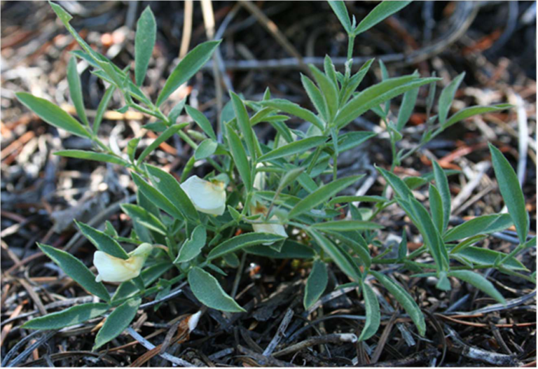
25 acres protected in 2016. On this special property, native plant enthusiasts collaborated with the Northcoast Regional Land Trust to protect a globally rare plant population that lives on the shoulders of their Red Mountain parcel in southeastern Humboldt County. The parcel includes a unique geological formation that is inhabited by the cryptic two-flowered pea (Lathyrus biflorus).This plant species is restricted to the slopes of Red Mountain, with about 95% of its entire population occurring on the parcel. The Land Trust’s partnership with these landowners led to a conservation easement that protects the pea, the property’s unique geology, and associated forest habitat.
-
Sproul Creek
Sproul Creek
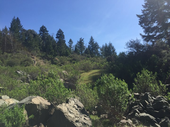
9,291 acres protected in 2018. Located southwest of Garberville, the Sproul Creek Conservation Easement contains over twenty miles of streams that contribute to the South Fork Eel River watershed. The property is largely comprised of mixed Douglas-fir and redwood forest with a unique 21-acre oak woodland stand. The property’s forests, streams, and meadows provide habitat for a number of fish, bird, mammal, and amphibian species, including coho salmon, steelhead, northern spotted owl, and bald eagle.
“The Northcoast Regional Land Trust offers our gratitude to Boyle Forests for their donation of an easement that will forever prevent subdivision and development in a watershed recognized as one of the best coho salmon strongholds in California” said Dan Ehresman, NRLT Executive Director. Following the completion of the conservation easement, Green Diamond Resource Company purchased the Sproul Creek property, which will be managed under their long term, property-wide agreements with the Department of Fish and Wildlife, the Regional Water Board, and under Forest Stewardship Council standards.
-
The 3 Vs
The 3 Vs
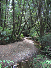
320 acres protected. In 2002, the Land Trust completed its first project – the acquisition of 320 acres in the Mattole Watershed, which includes old-growth forests and salmon-spawning tributaries. With assistance from the Coastal Conservancy, and in partnership with Sanctuary Forest Inc., the Land Trust was able to purchase the land and has now donated it to the Bureau of Land Management for permanent protection for its natural values. This property fills a gap between two parts of the Sinkyone Wilderness State Park on the border of Humboldt and Mendocino Counties, approximately four miles from the ocean.
-
Valley View Ranch
Valley View Ranch
1,532 acres protected in 2008; a Six Rivers to the Sea property. Lorana and Francis Sweet’s family has been on the Valley View Ranch since 1940. Before that the Russ Family, with whom Francis is related through marriage, owned the land since 1888.
Despite financial hardships over the years, the family has been committed to the conservation and preservation of their land and have diligently avoided subdividing or changing the historic (agricultural and forestry) uses of the property.
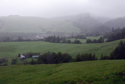
The Valley View Ranch property is visible along a 4-mile stretch of the county’s Mattole Road, forming the visual backdrop to the town of Petrolia. It is a pastoral scene with timbered slopes and gullies, heavy cottonwood and willow thickets lining the North Fork Mattole River; and, on the alluvial flats, sheep, cattle, and wildlife share perennial pastures, unbroken and smooth except by several parallel watercourses shaded by woody vegetation.
Both the North Fork Mattole River and Mill Creek harbor native indigenous salmonid species including resident populations of steelhead, native cutthroat, and coho. Winter chinook utilize both streams for spawning. State or federally listed species are known or suspected to utilize the property as well, including northern spotted owls, golden eagles, red and yellow-legged frogs, and red tree voles. Mountain lion, black bear, coyote, and blacktail deer also occur on the property.
As Francis puts it, “Ranching and the land has been my way of life, it’s what I believe in. I have been ranching on a small scale my whole life, and I actually worked on this property as a young man … when the property became available to me, I jumped at the opportunity because it was what I wanted all my life. The main reason for doing a conservation easement is to keep the land intact as a working ranch and forest and to ensure my family unit.”
-
Wagner Forest
Wagner Forest
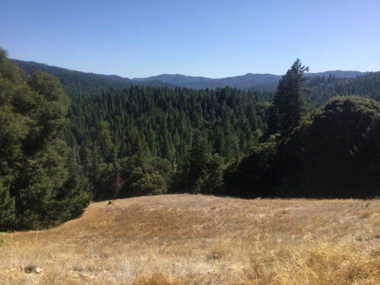
3,348 acre conservation easement in progress. NRLT is proud to be working with the Wagner family to conserve their ranch in southern Humboldt County. The family has tended this predominantly forested property since the late 1800s and they have recent awards from The Buckeye (among others) to show for their family’s commitment to sustainable land stewardship. Numerous salmon-bearing streams traverse the property and drain into the South Fork Eel River watershed, which is recognized by state and federal agencies as one of the best remaining salmon strongholds in California.
The ranch is strategically located between the 2,942-acre Marshall Ranch Conservation Easement, held by the California Rangeland Trust, and the 9,291-acre Sproul Creek Conservation Easement, held by NRLT. Completing an easement on the Wagner Ranch will create a contiguous block of privately conserved forestland of over 15,000 acres. Combined with the adjacent public lands including Richardson Grove State Park, these projects create nearly 20,000-acres of conserved mixed conifer-hardwood and redwood forest with a smattering of true oak stands and grassland. In early 2020, the Wagner Forest Conservation Easement project was selected by the California Department of Fish and Wildlife for Funding up to $5 million thanks to their Proposition 1/68 grant program. Combined with a previously awarded CAL FIRE Forest Legacy Program grant, we now have full funding to acquire a conservation easement on this property.


